Category:測地学

赤道
Equator▲2 trends
子午線
Meridian (geography)
水沢VLBI観測所
測地系
Geodetic datum
衛星測位システム
Satellite navigation
Metashape
Metashape
フランス科学アカデミーによる測地遠征
French Geodesic Mission to the EquatorGRS80
Geodetic Reference System 1980
電子基準点
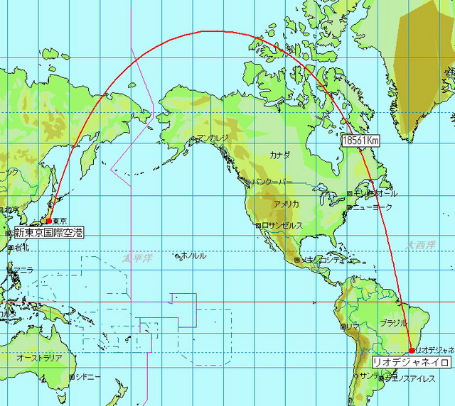
大圏コース
Great-circle navigation
地図
Map
水準点
Benchmark (surveying)
測地学
Geodesy
測地線
Geodesic
写真測量法
Photogrammetry
マップコード
Denso mapcode基準系
Frame of reference
リアルタイムキネマティック
Real-time kinematic positioning
卯酉線
Prime vertical
子午線弧
Meridian arc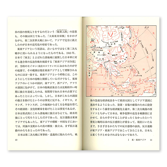
中国における地理的データの制限
Restrictions on geographic data in China
地球情報学
Geoinformatics
3Dスキャニング
3D scanning
地理極
Geographical pole
頂上
Summit
グローバル・ポジショニング・システム
Global Positioning System
東南アジアの基準点網
海面地形
Ocean surface topography
