Category:リモートセンシング
人工地震
Induced seismicity
コウモリ探知機
Bat detector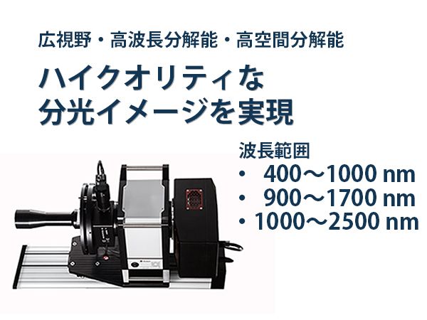
ハイパースペクトルイメージング
Hyperspectral imaging
デジタルグローブ
DigitalGlobe
人工電流源電磁探査法
Controlled source electro-magnetic
向井苑生
Google Earth
Google Earth
Marble (ソフトウェア)
Marble (software)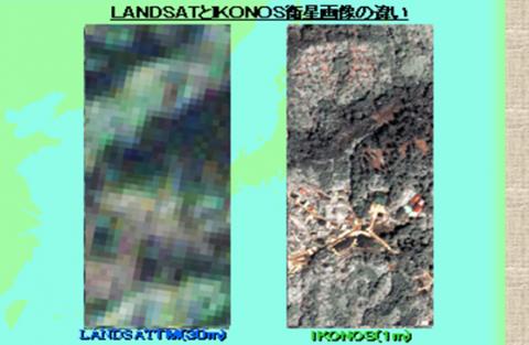
ASTER (リモートセンシング)
Advanced Spaceborne Thermal Emission and Reflection Radiometer
リモートセンシング技術センター
全球地球観測システム
Global Earth Observation System of Systems
地上サンプル距離
Ground sample distance
GNSSリフレクトメトリ
GNSS reflectometry
レッドエッジ
Red edge
熱赤外分光法
Thermal infrared spectroscopy
リニアメント
Lineament
反響定位
Animal echolocation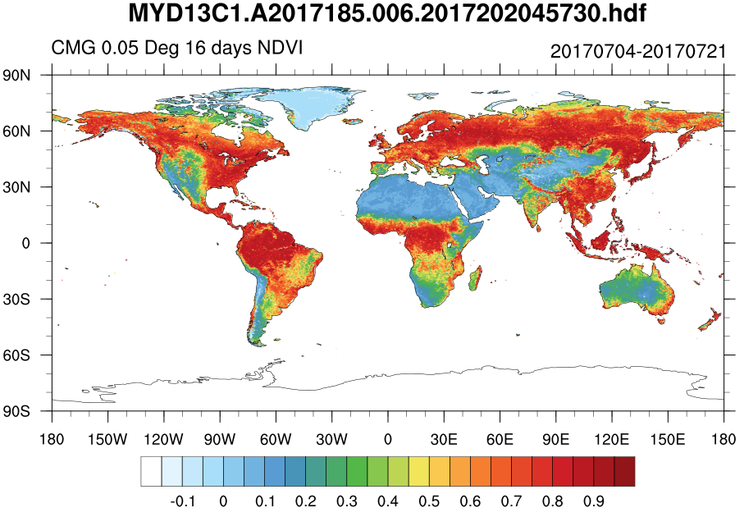
NDVI
Normalized difference vegetation indexリモートセンシング
Remote sensing/cloudfront-ap-northeast-1.images.arcpublishing.com/sankei/LIWZZIBCUZKM3O3LM37MZSXY2M.jpg)
マクサー・テクノロジーズ
Maxar Technologies