Category:地理技術
QGIS
QGIS
Metashape
Metashape
GDAL
GDAL
GeoServer
GeoServer
写真測量法
Photogrammetry
衛星画像
Satellite imageryヤンデックスマップ
Yandex Maps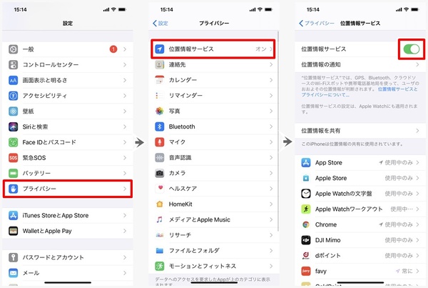
位置情報サービス
Location-based service
KH-5
KH-5 Argon
地球統計学
Geostatistics
GeoClue

COVID-19アプリ
COVID-19 apps
Geo-Wiki
Geo-Wiki
OSM財団
OpenStreetMap Foundation
Nコード

天地図
TiandituGeoRSS
GeoRSSGISTBoK
Geographic Information Science and Technology Body of KnowledgeGeoCMS
Geospatial content management systemGlobal Administrative Unit Layers
Global Administrative Unit Layers
GRASS GIS
GRASS GISISO 19100

ISO 6709
ISO 6709Mapnik
Mapnik
Point of interest
Point of interest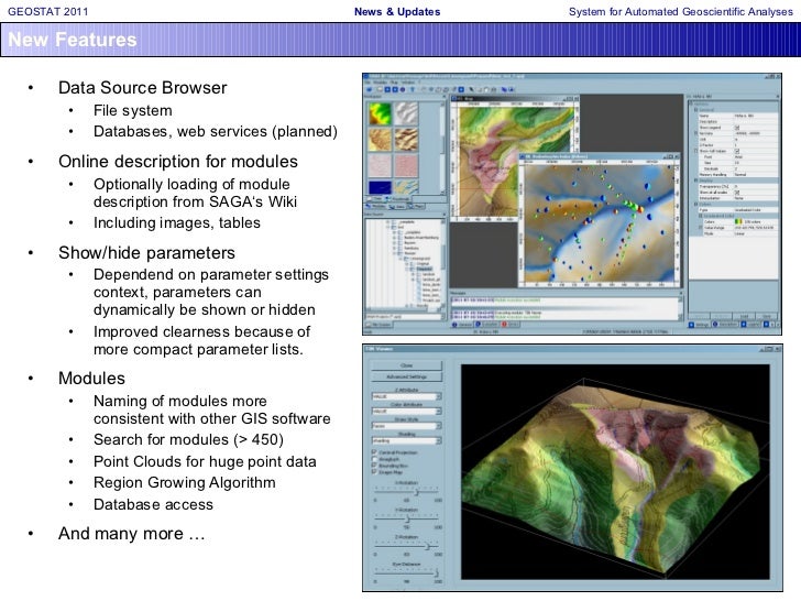
SAGA GIS
SAGA GIS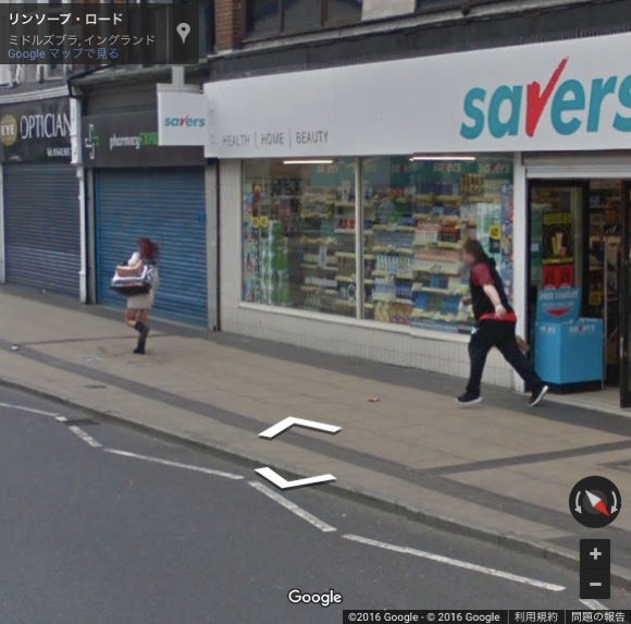
Google ストリートビュー
Google Street View
航空レーザー測量