Category:GIS

ポリゴン
Polygon (computer graphics)
WebGIS
Web GIS
空間インデックス
数値標高モデル
Digital elevation model
地理情報科学
Geographic information science
数値地図
Map#Electronic maps
ボランタリー地理情報
Volunteered geographic information
CloudMade
LandView
LandView
イー・ソリューション・サービス
Geographic Data Files
Geographic Data Files
AM/FM/GIS
AM/FM/GIS
Open Geospatial Consortium
Open Geospatial ConsortiumOrfeo toolbox
Orfeo toolbox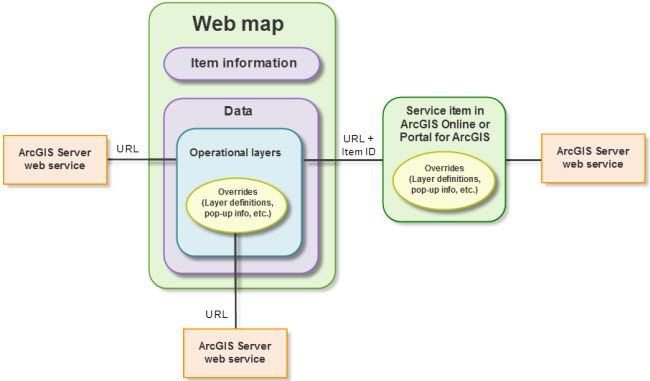
Web Map Service
Web Map Service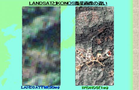
ASTER (リモートセンシング)
Advanced Spaceborne Thermal Emission and Reflection Radiometer
ウェブマップタイルサービス
Web Map Tile ServiceShuttle Radar Topography Mission
Shuttle Radar Topography Mission
スモールワールド (企業)
Smallworldタイルマップサービス
Tile Map Service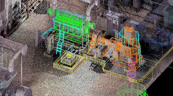
点群 (データ形式)
Point cloud
JPGIS

地理空間情報活用推進会議
日本デジタル道路地図協会

ジャック・デンジャモンド
Jack Dangermond
オルソ補正
Orthophoto
ジオアイ1号
GeoEye-1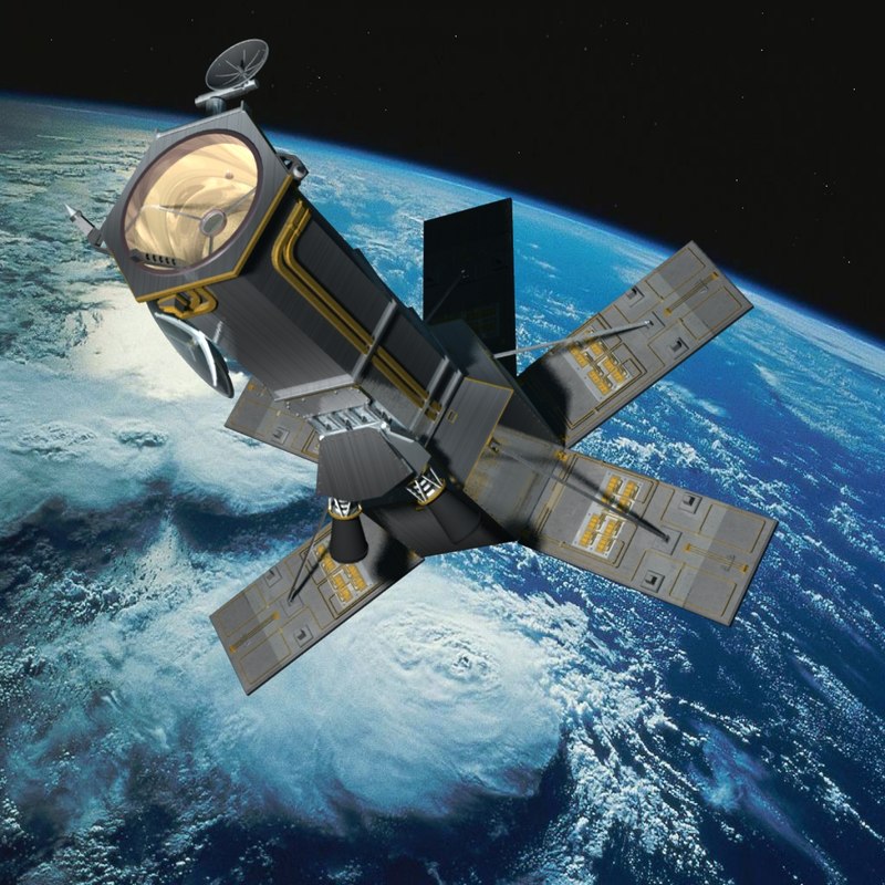
WorldView-4
WorldView-4