Category:測地学
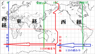
子午線
Meridian (geography)
ポールシフト
Cataclysmic pole shift hypothesis
衛星測位システム
Satellite navigation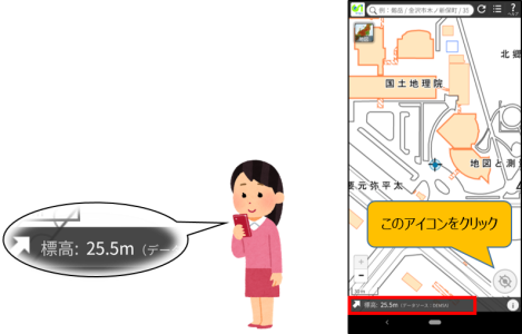
標高
Elevation
マップコード
Denso mapcode
Z項
国際地球回転・基準系事業
International Earth Rotation and Reference Systems Service
リアルタイムキネマティック
Real-time kinematic positioning
水平
Horizontal direction
測地学
Geodesy基準系
Frame of reference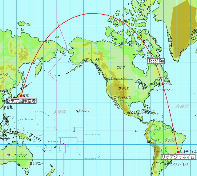
大圏コース
Great-circle navigation
Metashape
Metashape
頂上
Summit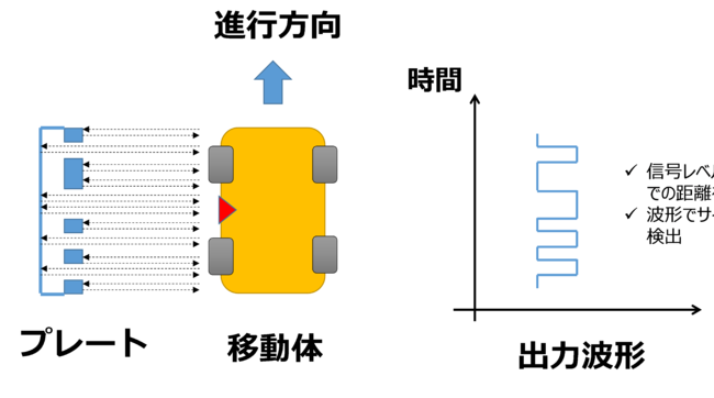
国際レーザー測距事業
重力測定
Gravimetry
3Dスキャニング
3D scanning
フランス科学アカデミーによる測地遠征
French Geodesic Mission to the Equator
潮汐加速
Tidal acceleration
地球情報学
Geoinformatics
ムーニエの定理
Meusnier's theorem
国際緯度観測所
International Latitude Service
国際VLBI事業
東南アジアの基準点網
海面地形
Ocean surface topography
地球の軌道
Earth's orbit
オイラーの定理 (微分幾何学)
Euler's theorem (differential geometry)DORIS (衛星測位システム)
DORIS (satellite system)